

Hiking - Berg & Sonne -
Popular hiking trails near Lake Millstatt
Carinthia is a true paradise for hiking enthusiasts, and the region around Lake Millstatt offers a variety of hiking trails for every level. Whether you prefer leisurely walks along the lake shore or challenging mountain tours, you are guaranteed to find the right route here.

Hike to the Garnet Gate
- Duration: approx. 3.5 hours (there and back)
- Difficulty: moderate
- Elevation gain: approx. 400 m
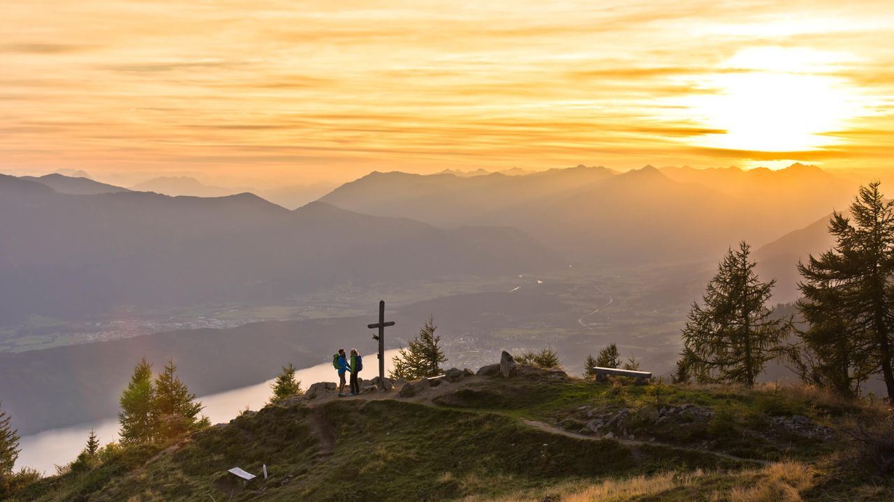
This hike takes you from the Lammersdorfer Hut (1,650 m) to the impressive Granattor at an altitude of 2,060 m. Along the way, you can enjoy magnificent views of Lake Millstatt and the surrounding mountains.
Egelsee circular trail
- Duration: approx. 1.5 hours
- Difficulty: easy
- Elevation gain: approx. 100 m
A leisurely circular route that takes you through idyllic forests to the picturesque Egelsee lake. The moor lake captivates visitors with its unspoilt nature and offers peace and relaxation.


Via Paradiso – Stage 4
- Duration: approx. 4 hours 40 minutes
- Difficulty: moderate
- Elevation gain: 613 metres
This stage of the long-distance hiking trail takes you along Lake Millstatt and offers impressive panoramic views and cultural highlights along the route.
Alpe-Adria Trail
The Alpe-Adria Trail is a long-distance hiking trail that runs from the Großglockner in Austria to the Adriatic coast in Italy. The total length is approximately 750 kilometres, divided into 43 stages with an average length of around 17 kilometres per stage.
Stage 12: Seeboden on Lake Millstatt – Millstätter Alpe
- Length: approx. 24 km
- Duration: approx. 8 hours
- Difficulty: challenging
- Elevation: ascent approx. 1,500 m, descent approx. 300 m
On this stage, hikers encounter the gentle peaks of the Nockberge Mountains for the first time, which are part of the Gurktal Alps in Carinthia. The Tschiernock offers a unique view of the Lieser and Malta valleys.

Nockalm Trail – Tschierweger Nock
- Duration: approx. 5 hours
- Difficulty: difficult
- Elevation: ascent 130 m, descent 1,300 m
- Length: approx. 15 km
The route leads from the Millstätter Hütte to the 2,010 m high Tschierweger Nock and then steeply down to Seeboden on Lake Millstatt. Breathtaking views of the Nockberge mountains included!
Practical tips for hikers
For your hikes around Lake Millstatt, we recommend good equipment: sturdy shoes for the unpaved paths, a weatherproof jacket for the mountain regions and, of course, enough water and a small snack to keep you going. If you prefer digital support, you will find many GPS tracks online. However, a classic hiking map is often a great addition. The tourist offices also provide helpful maps and valuable tips on current conditions.
The best time for hiking in Carinthia is from spring to autumn. In spring, the alpine meadows awaken in bright colours, summer offers perfect conditions for extended tours with magnificent views, and autumn enchants with its golden forests and clear air. Even in winter, you can experience the tranquillity of snow-covered nature while winter hiking or snowshoeing.